Tag: water

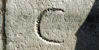
Tide Level Zero of the Punta della Salute

Indicates the median tide level, in reference to the tide-gauge at the Punta della Salute. The tide-level zero at the Punta della Salute is approximately 23 cm lower than the tide-level zero established by the Istituto Geografico Militare (IGM).

Underground utilities

The technological grids running underground (water, electrical ppower, gas and traditional telephone lines).

Palancole

Formwork with a corrugated profile. Driven into the ground, it makes it possible to pump the water out of a canal to drain it entirely and create a watertight barrier along a section of embankment.

Venetian wells

Venice’s underground does not have easy-to-reach water tables. Up to a century ago, fresh water was drawn from the springs on the mainland and transported in casks to the lagoon by boat. This supplemented the traditional rainwater collection system built in the campi and campielli.

The “comune marino”

The words “common high tide”, “common marine” or simply “common” indicated the height that must be referred to, for example, when setting the foundations of a building six feet “below the common”, dredging the bed of a canal five feet “below the common” or establishing the upper edge of the embankments at two feet “above the common”.


Copyright © 2020 Venice Backstage Insula spa, operational division of Venice Municipality; direzione Patrimonio e casa, settore Inquilinato e politiche della residenza; direzione Progettazione ed esecuzione lavori; direzione Programmazione e controllo, settore Programmazione e controllo opere pubbliche e Legge speciale. Designed by teodolinda.it, based on Aperture theme by woothemes.com